

South America 2. Bolivian Altiplano, Salar de Uyuni

The Bolivian Altiplano is the second largest mountain plateau in the world. Higher than many peaks around the world, the Altiplano is home to lifeless and surreal scenes. Near the Chilean border, the backdrop is dominated by jagged volcanoes; moving further into Bolivia, the rocky landscape transforms into a pristine salt flat – the famous Salar de Uyuni. The otherworldly attractions are very difficult to visit unless you follow a guided tour. Most itineraries through the region stop at various lagoons and remarkable rock formations, culminating in watching a fantastic sunrise over the vast salt flats. The terrain is sometimes so hostile that it is scarcely believable the Bolivian Altiplano could exist on Earth. We chose Tupiza Tours based on positive reviews and their reputation for safety. Our drivers drove safely, and our guide Gladys was helpful and sociable. While more expensive than other tour options, Tupiza Tours were professional and accommodating of our needs throughout.
Our tour through the Altiplano begins in Hito Cajon, the Bolivian border post high in the Andes. For political reasons, Bolivian tour providers are unable to cross into Chile and vice versa, so we had to find a way to Hito Cajon from San Pedro. Thankfully, we found a tour agency in San Pedro de Atacama which agreed to take us from our hotel to Hito Cajon via the Chilean border, a mere ten minutes from San Pedro. By the time we arrived, gravel-side vendors had already set up stalls with tea and snacks, a welcome reprieve from the frosty desert morning. After getting our passports stamped, we ventured into the barren wilderness, ascending along a mountainous road.
The Bolivian side of the border, at Hito Cajon, no more than a tiny shack occupied by two immigration officers, is forty minutes from the Chilean side (what, then lied in between?). Even in the early morning, 4×4s from different tours had already congregated. After a smooth border crossing and with tourist visas in hand, we boarded the 4x4s which would be our mode of transport across the Bolivian Altiplano for the next three days. With our luggage (along with sleeping bags, extra water, and even food) strapped precariously to the top of our jeeps, we entered the Eduardo Avaroa Andean Fauna National Reserve.

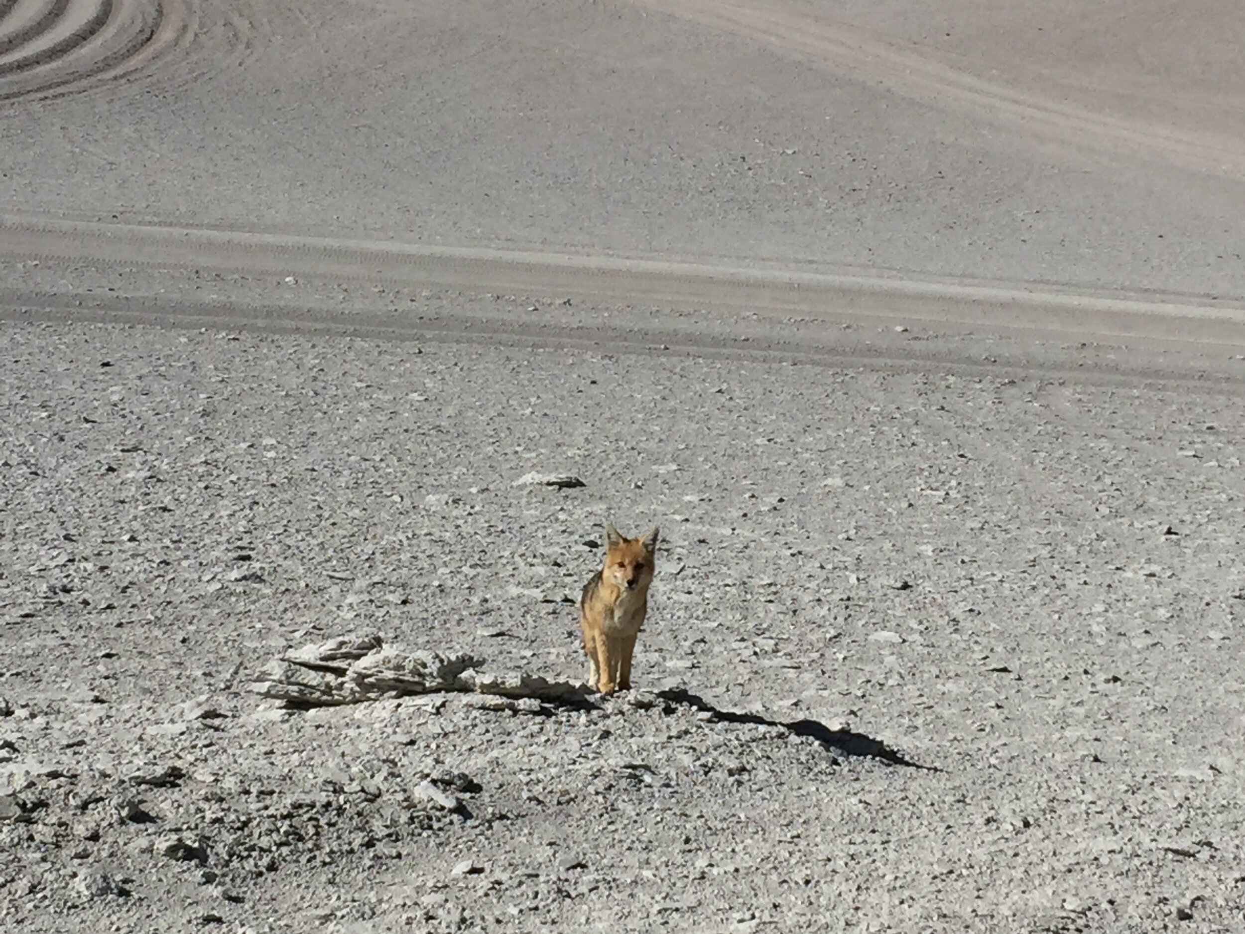
The entrance to the national reserve was set against a backdrop of the distant Andes and mesmerisingly blue skies. The incredibly clear sky was hardly a surprise: the Andean Altiplano is one of the driest regions in the world. The Atacama Desert and Altiplano are situated between two mountain ranges, preventing moist air from the Pacific Ocean or the tropical rainforest from reaching this isolated region. Some areas only receive a few millimetres of precipitation each year. As a result of this, the region is remarkably barren and lifeless.

We meandered around various lifeless lagoons at the foot of the towering Licancabur Volcano, including Laguna Blanca and Laguna Verde. Just by looking at the lakes, it is not difficult to imagine why NASA has planned expeditions to these lagoons. The salt lakes are characteristically coloured due to their different mineral compositions: for example Laguna Verde is so-named because of lead, sulphur and arsenic deposits. Depending on the wind speed and direction, the lake’s sediments can be agitated from the lake bed, transforming the lake’s swirling colours throughout the day.
These harsh environments harbour unique extremophiles, organisms which can thrive under even the most unforgiving conditions. Fascinatingly, the lakes surrounding the Licancabur Volcano are thought to be analogous to the ancient lakes found on Mars. The arid, cold, and wind-swept landscape was the training ground of choice for NASA, and was where they developed engineering strategies for planetary exploration and scientific sample collection. Indeed, the out-of-this-world landscapes look as though they were lifted straight from the surface of exoplanets.

We then visited the Salvador Dalí Desert, a muted and desolate valley so named because of scenes resembling Dalí’s surrealist paintings, only without the melting clocks. Oddly-shaped rock protrusions dot the landscape amid maroon mountain ranges, the result of thousands of years of wind erosion, funnelled into the valley from surrounding high-altitude regions.

Our jeeps then brought us to Termas de Polques hot springs, a small bathing area overlooking a salt lagoon. Upon being informed that this would be our last realistic chance to shower in the next two days, we all changed into swimwear and hopped in. The lukewarm springs were certainly a welcome change to the harsh Andean winds.

After a brief soak and a quick lunch, our tour continued on to Sol de Mañana, the highest geyser fields in the world. While somewhat less spectacular and less expansive than the El Tatio geysers, Sol de Mañana is instead more noxious, as it is made up of bubbling mud lakes and simmering steam pools. Filling the air with a thick sulphurous odour, the geyser field offers an up-close and personal view of the effervescing mud pools, a far cry from the perhaps more safety-conscious El Tatio Geyser field. The downside of the lack of barriers is that extreme care must be taken while walking around in the geyser fields, as any damped and cracked earth is potentially dangerous. Unsuspecting tourists have been known to fall into boiling mud pools.

After briefly reaching 5000m above sea level (where we breathlessly took a customary group photo), we descended to Laguna Colorada. Laguna Colorada derives its name from the crimson sediments and algae populating the lake. The lagoon is incredibly shallow, and is dotted with white islands of borax deposits, left behind as the water evaporates. Endangered James’s flamingos, endemic to the Andean Altiplano, feed on the red algae, giving rise to the characteristic pink feathers. We strolled along the shores of the lagoon, hoping to catch a closer glimpse of the flamingos, but the rapidly cooling air and the effects of altitude sickness soon caught up to us. As the sun descended beneath the nearby mountains, we retreated to a nearby village, where we spent the night under the starry Andean sky, the frigid cold unable to deter us from briefly heading outside for another spectacular view of the Milky Way.

The sun had barely risen as we departed the village to a nearby mirador overlooking Laguna Colorada. The familiar flamingos were now joined by llamas grazing on the edge of the lake. The lagoons are surrounded by tufts of the straw-like Jarava ichu, the rare plant capable of withstanding the utter lack of precipitation. Ichu, as it is more commonly known, is mostly used as livestock feed for the villages dotted around the austere Altiplano.

Another fascinating type of vegetation is the yareta, which, from afar, looks like nothing more than a moss-covered rock. In fact, they are a type of flowering plant with very dense leaves, thus resembling a compact mat of moss. Growing extremely slowly at around 1 cm a year, some yareta plants are thought to be over thousands of years old. Being dry and dense, yareta was traditionally harvested as fuel, but its slow growth makes this practice extremely unsustainable.

From there, we sped back into the Siloli Desert, famed for the surrounding rainbow-tinted mountains and bizarre collection of rock formations. Climbing some of the more stable rock formations proved to be exhausting due not to our collective lack of fitness, but to the breathlessness that accompanies the extreme altitudes. Particularly striking among the rock formations is the Ãrbol de Piedra, or tree of stone, with a broad and blistered upper section balancing precariously on its narrow trunk. The shape, in particular the thin stem, is due to wind erosion and abrasion from sand.

Speeding along, we next visited a string of lagoons along the Bolivia-Chile border, including Laguna Honda, Laguna Cañapa, and most notably, Laguna Hedionda. These lagoons all sit in the shadow of the majestic Ollagüe Volcano. The pungently sulphuric Laguna Hedionda is populated by tens if not hundreds of flamingos. The extravagant flamingos become stuck in the lake as it freezes overnight while they sleep; they are only freed as the desert sun warmed the air. Occasionally, the flocks would take flight, the sound of flapping wings temporarily distracting from the howling desert winds.

Of the six flamingo species in the world, three (the Chilean, Andean and James’s Flamingos) are endemic to the Altiplano and can be found in large numbers around the lakes and lagoons of the reserve. They have adapted to the extreme conditions in the region, feeding primarily on algae which thrive in these lakes. Flamingos' habitats are constantly under threat from human activity. The birds and their breeding habits are exquisitely sensitive to the environment. Subtle changes due to mining as well as more imminent threats such as egg harvesting have detrimentally affected their population.

Having been deceived by a sign promising Wi-Fi (which, as it turns out, is only available for guests of a hotel), we veered away from the Bolivia-Chile border, reaching Salar de Chiguana. A salt flat in its own right, Salar de Chiguana borders the much larger and more impressive Salar de Uyuni. A lone railway cuts through the salt flat and is used for transporting mined salt from Uyuni to the Chilean border. Regardless of the impracticalities of having a lone railway on which only one carriage transports salt at any time, the elevated railway still makes for a unique photo opportunity. We did have to hurriedly leave the tracks as an angry train carriage driver sped past!

A brief detour brought us to Gruta de las Galaxias, a prehistoric cave formed of fossilised algae. We also visited a nearby pre-Incan grave, dug from the bedrock of a natural cave. Sadly, colonial graverobbers had removed all of the treasure and mummified bodies from these graves. Fossilised algae lines the walls of the cavern. It boggles the mind to think that a cave, which is today 3500 m above sea level, once resided at the bottom of the ocean.

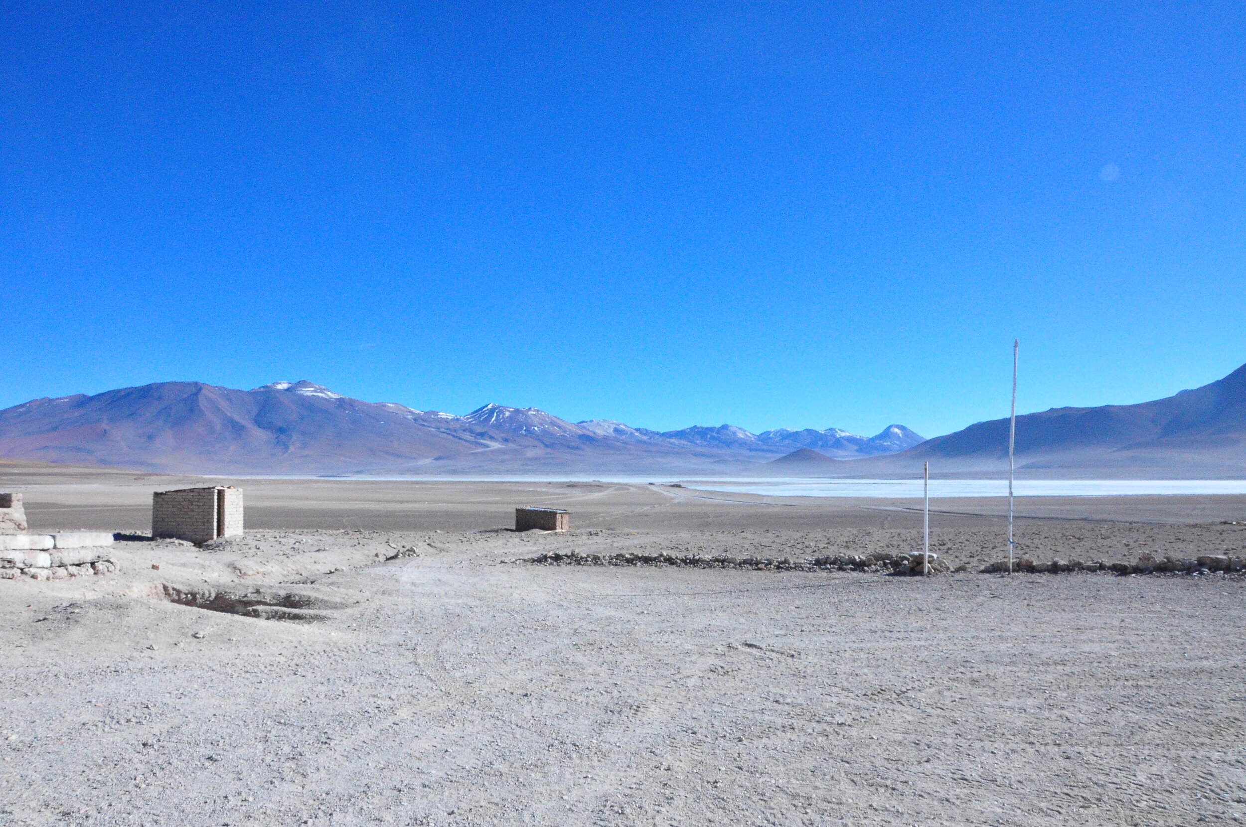
As dusk drew near, we ended the day by travelling to a salt hotel, which was thankfully warmer and more comfortable than our previous night’s accommodation. The salt hotel is almost entirely constructed out of blocks of compacted salt. The arid climate means that the salt constructions can last indefinitely. Imagine our joy when we found out that warm water showers were available!
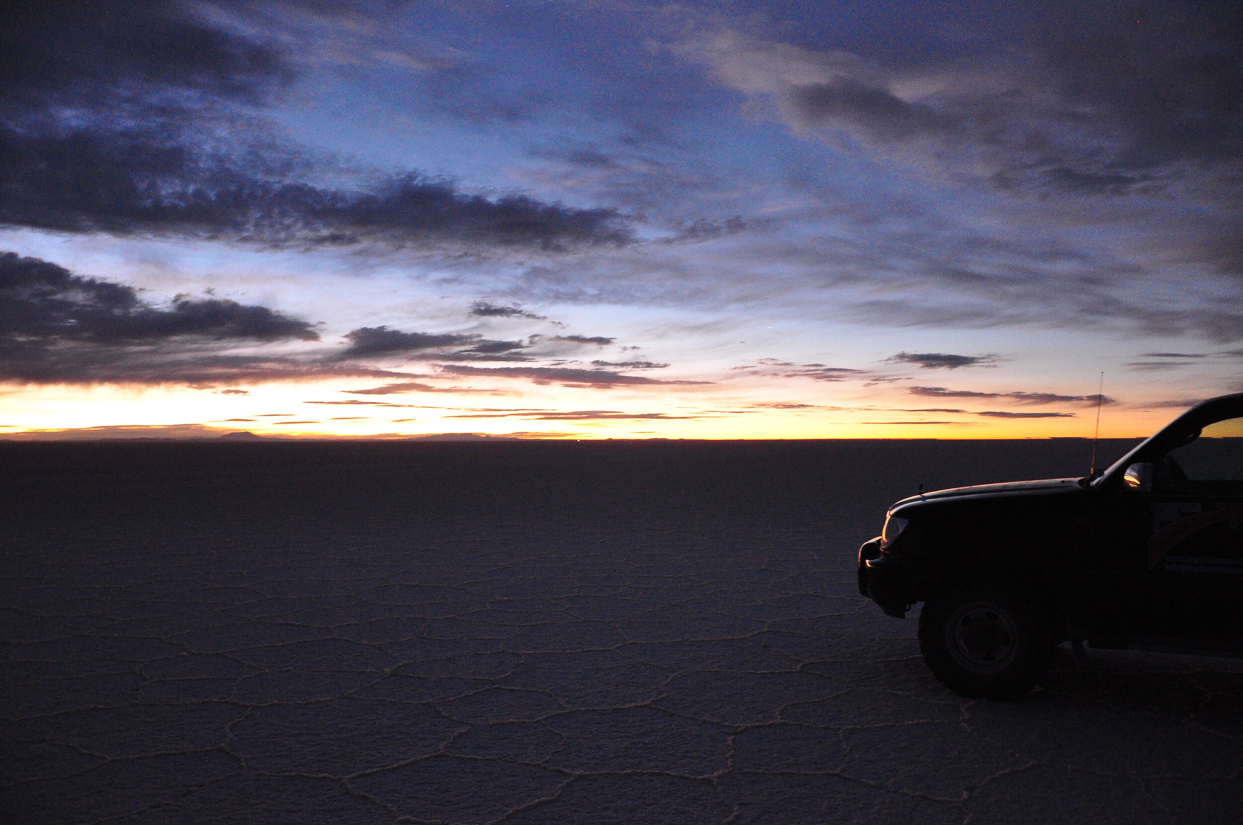
The final day of our tour started as we sleepily boarded our 4×4s in the dark at 5 a.m. The sandy gravel of the desert gradually transformed into crystalline salt, crunching underneath our tyres as the jeeps relentlessly rolled along. We had finally bid farewell to the Altiplano desert, entering the immense Salar de Uyuni. While we departed the hostel with several other tour groups, the noises from other engines soon grew distant as our jeeps parted ways.

After finding an unobstructed view of the horizon, our vehicles came to a halt and we watched the sun rise over the salt flats. Braving the cold to watch the spectacular vermillion sunrise over the salt flats, the group witnessed a blush spread like wildfire across the horizon.
Soaking in the serenity of the sunrise, we advanced to the nearby Incahuasi Island, the remnants of a prehistoric submerged volcano in the centre of the Salar. Strikingly, the island is populated by massive cacti; in turn, dried cacti are used to build structures on the island, given that the surroundings are completely devoid of any usable vegetation. The island is also a centre of religious significance, especially during the summer solstice, when massive festivities on the island attract surrounding locals. During these festivities, various tributes and sacrifices are made to Pachamama (Mother Earth), seeking her blessing. The summit provides spectacular views of surrounding volcanoes and the vast Salar, marked by jeep tracks radiating outwards from the island.


By the time we descended the island, bidding our farewell to Luna the dog, morning had well and truly broken. The overcast evaporated to reveal an azure sky and the brilliant sun. We ventured even deeper into the lifeless Salar. The Salar is stunning. Nothing quite prepares you for the interminable whiteness of the largest salt flat in the world, its incredible brightness reflecting the unrelenting sun. The lack of any drainage outlets meant that the salt remained after evaporation of the large prehistoric lagoon, forming satisfyingly regular hexagonal honeycombs. Throughout the year, Salar de Uyuni is covered by a few metres of salt most of the year, whose altitude varies no more than a metre over its entirety. With no visible point of reference, cruising along the Salar was disorienting and almost hallucinogenic. In a region where even GPS does not function properly, it was a minor miracle that our drivers had an intuitive sense of our direction of travel.

The salt flats become even more incredible when it rains. Several centimetres of rain suffice to transform the salt flats into the world’s largest mirror, with its near-perfect flatness giving rise to incredible reflections of the surrounding mountains. We were unlucky to travel through the Salar during the dry season, preventing us from observing the famed mirror effect. The Salar's flatness and lack of background perspective allowed forced perspective photos to be taken. Even our tour guide and the drivers joined in with brainstorming photo ideas and taking photos for us! After a gruelling brainstorm session of photo ideas, and what felt like hours setting up for the photos, we were again on our way. On the edge of the Salar, we stopped for our farewell lunch and a brief shopping detour in a street market.

Finally reaching paved roads, we journeyed towards Uyuni, a small and frankly unclean town bordering the Salar. The amount of rubbish we saw on the streets was in stark contrast to the untainted purity of the Salar and the surrounding lagoons. We finally finished our tour with a visit to the Cemeterio de Trenes (cemetery of trains), an area with numerous rusted locomotives once used by mining companies, together forming a steampunk dream. Returning to Uyuni, we bid farewell to our guides, and left for hectic and bustling La Paz the same afternoon.

The Bolivian Altiplano is home to some of the most incredible natural attractions on the planet, and we were sad to leave the amazing scenery behind. Unencumbered by worldly troubles and devoid of tourist encounters, the high plains afford the rare chance to truly immerse in the natural backdrop. Departing Uyuni, we were keen to swap natural beauty for the hustle and bustle awaiting us in La Paz.
With more time…
There are several potential destinations following the Salar tour. These include Sucre, the constitutional capital of Bolivia, noted for swathes of chalk-white colonial buildings; Potosí, a relic of Bolivia’s silver-mining past, where tours to cooperative mines can be arranged.
The main advantage of beginning a tour in Hito Cajon is that this itinerary ends at the Salar on the final morning with a sunrise over the salt flats. Tours are also possible from Tupiza (near the Argentinian border) or Uyuni.
